RF intelligence cuts through contested waters, making China’s presence more visible.
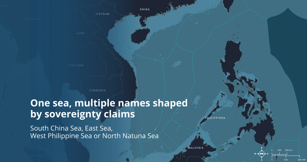
In the West Philippine Sea—the portion of the South China Sea adjacent to the Philippines and within the Philippines’ Exclusive Economic Zone (EEZ)—Chinese Coast Guard (CCG) units and maritime militia maintain a persistent posture around disputed features near the Spratly Islands and Scarborough Shoal. Merchant shipping intersects with industrial and small-scale fishing, while law-enforcement and naval patrols operate in tight proximity. In this crowded theater, cooperative signals can be inconsistent, and visibility is frequently shaped by gray-zone tactics rather than transparency.
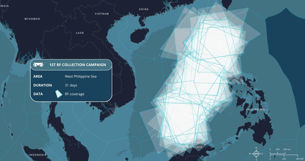
To cut through that uncertainty, Unseenlabs observed the same area of interest twice, several months apart, using the same space-based RF methods to create comparable views over time and distinguish routine movement from behavior of interest. Within this period, we also followed a prominent CCG Guard vessel operating not far from the Spratlys; when its AIS went silent, our space-based RF intelligence and fingerprinting maintained continuity and kept the track alive.