The Arabian Sea is a region of the northern Indian Ocean bounded on the west by the Arabian Peninsula, on the southwest by Somalia, and on the east by India. This sea covers a large area of over 3.8 million km2, and is part of the Indian Ocean while being connected to the Red Sea and the Persian Gulf. It appears to be one of the main sea routes, especially for hydrocarbons and freight transport.
The Arabian Sea – that used to be an area with abundant fish stocks – is in constant decline for more than a decade. It is mainly due to overfishing, pollution (plastic, hydrocarbons) and climate change.
Some species are particularly threatened. For instance, in some Asian countries many shark species, like the sand tiger shark, are killed for their meat or fins. Furthermore, they are often fished by accident and thrown dead into the sea.
Last February, and for several days, Unseenlabs carried out an RF data acquisition campaign in the Arabian Sea to geolocalize uncooperative vessels (AIS turned-off), and to characterize those of them that are likely to engage in Illegal, Unreported and Unregulated (IUU) fishing.
The ship’s kinematic suggests that there is a possibility of IUU fishing in this zone. Some fishing vessels switch-off their AIS beacon to become “invisible” for several hours or days. They enter Exclusive Economic Zones (EEZ) to fill their fishing nets and make many round trips to unload fish in other ships located outside the EEZ. They can collect a larger number of fish as they gain more cargo space.
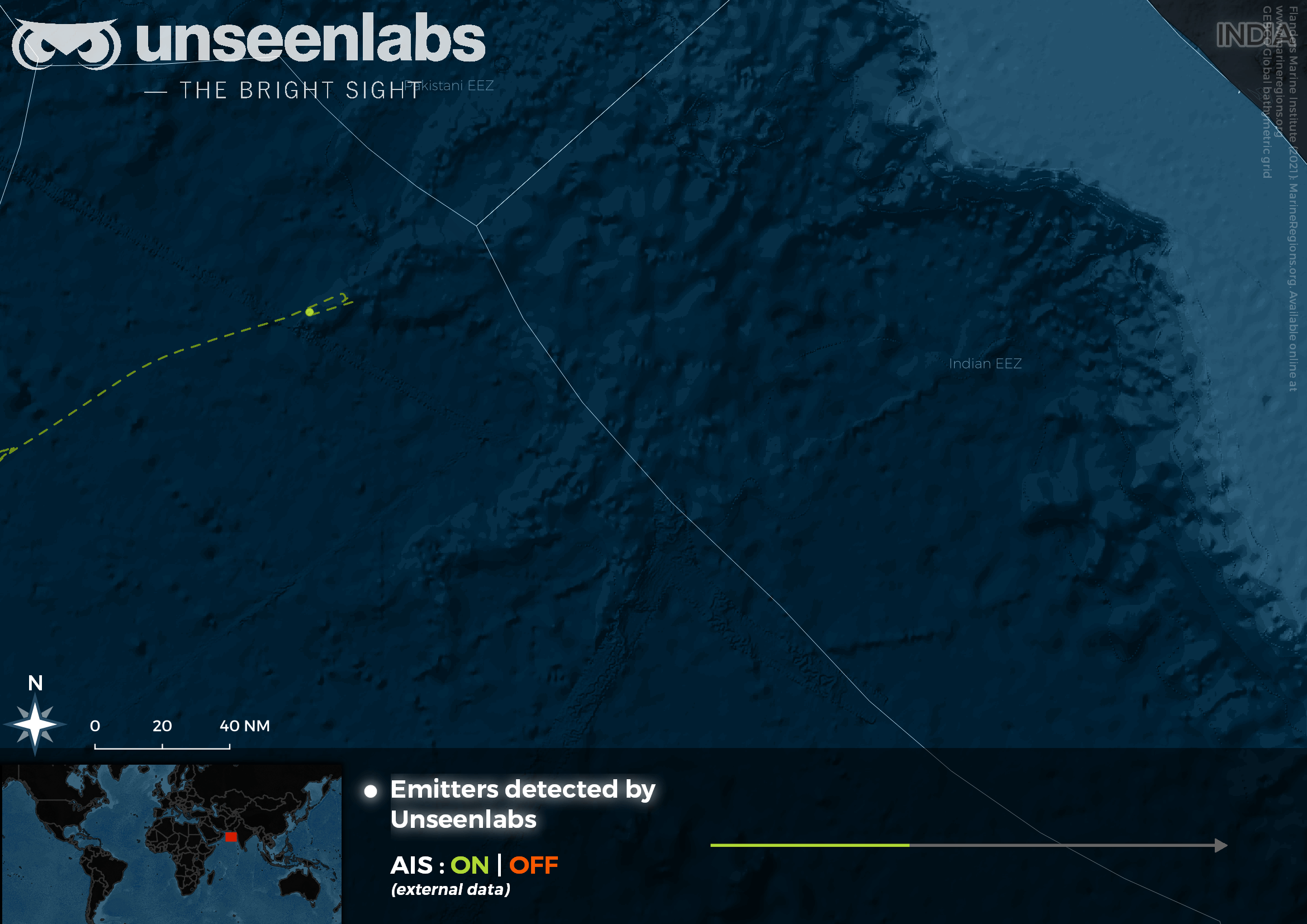
Day 1 – A Chinese-flagged fishing vessel (>1,100 GT) was localized at 60 NM outside the Indian EEZ before turning-off its AIS for 42 hours.
Day 2 – evening: Thanks to the emitter’s RF characterization, we geolocalized this ship at 100 NM inside the Indian EEZ.
Day 3 – mid-day: After 42 hours of AIS interruption, the ship is now located at 80 NM outside the EEZ and is navigating in a southwest direction.
Day 4 – morning: The ship meets another Chinese-flagged fishing vessel at sea (fish carrier size > 5,000 GT).
Thanks to its space-based RF technology, Unseenlabs confirms that there is IUU Fishing in this zone. These situations are often published through open-source information but are still difficult to catch or demonstrate in real life.